File:BermudaTriangleMap.png
Dettagli
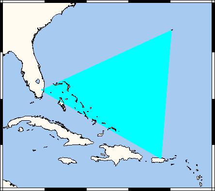
| Descrizione | Map showing supposed extent of Bermuda Triangle. This map's source is here, with the uploader's modifications, and the GMT homepage says that the tools are released under the GNU General Public License. |
| Data | 18 aprile 2006 (data di caricamento originaria) |
| Fonte | Trasferito da en.wikipedia su Commons. |
| Autore | Kelisi di Wikipedia in inglese |
| Altre versioni |
[]
|

.svg)


.svg)

.svg)


.png)
.png)


Licenza
|
Note: "subject to disclaimers" below may not actually apply. This file was tagged with {{GFDL-user-en}}, and after May 2007, Template:GFDL-self (on English Wikipedia) did not require disclaimers. Please check the image description page on the English Wikipedia (or, if it has been deleted, ask an English Wikipedia administrator). See Wikipedia:GFDL standardization for details.
| ||||||||
Kelisi da en.wikipedia.org, detentore del copyright su quest'opera, dichiara di pubblicarla con la seguente licenza:
| ||||||||
|
Note: This tag should not be used. For images that were released on the English Wikipedia using either GFDL or GFDL-self with disclaimers, use {{GFDL-user-en-with-disclaimers}}. For images without disclaimers please use {{GFDL-user-en-no-disclaimers}} instead. If you are the copyright holder of files that were released on Wikipedia, please consider removing the disclaimers. |

Registro originale del caricamento
- 2006-04-18 20:13 Kelisi 444×394×8 (6406 bytes) Map showing supposed extent of Bermuda Triangle. This map's source is [http://www.aquarius.geomar.de/omc/make_map.html here], with the uploader's modifications, and the [http://gmt.soest.hawaii.edu/ GMT homepage] says that the tools are released under the

|
Questa immagine (categorizzazione automatica: map of north america) o tutte le immagini in questa categoria o galleria dovrebbero essere ricreate usando grafica vettoriale come file SVG. Questo offre diversi vantaggi: vedi Commons:Media for cleanup per maggiori informazioni. Se è disponibile una versione in formato SVG di questa immagine, per favore caricala. Dopo aver caricato un file SVG, sostituisci questo avviso con il template {{Vector version available|nome_immagine.svg}}.
|
Cronologia del file
Fare clic su un gruppo data/ora per vedere il file come si presentava nel momento indicato.
| Data/Ora | Miniatura | Dimensioni | Utente | Commento | |
|---|---|---|---|---|---|
| attuale | 14:35, 21 mar 2007 | | 444 × 394 (6 KB) | wikimediacommons>Liftarn | {{Information |Description=Map showing supposed extent of Bermuda Triangle. This map's source is [http://www.aquarius.geomar.de/omc/make_map.html here], with the uploader's modifications, and the [http://gmt.soest.hawaii.edu/ GMT homepage] says that the t |
Utilizzo del file
La seguente pagina usa questo file: